
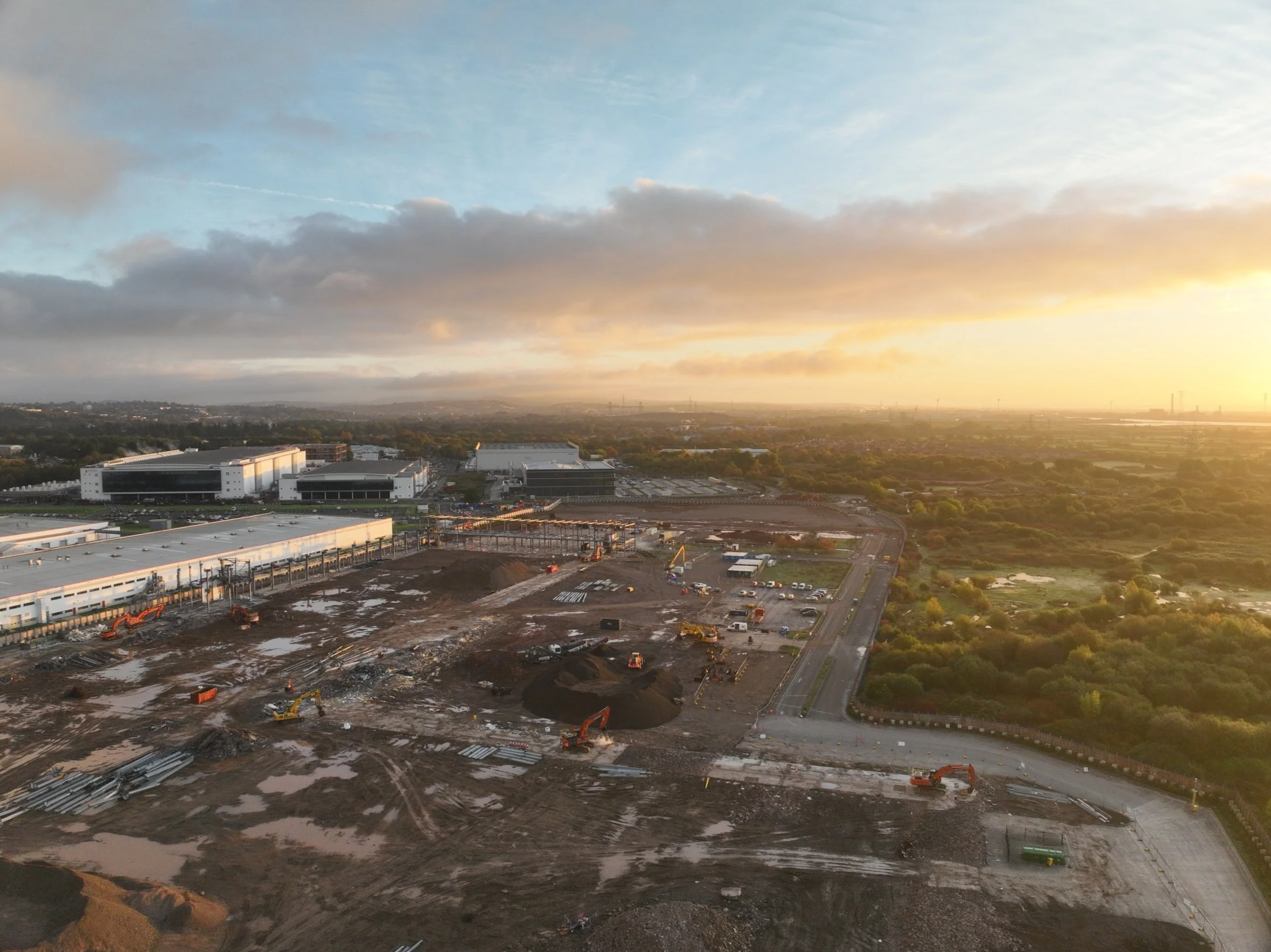
The Importance of UAVs in Construction: Beyond Progress Reports
Building Smarter with UAV Technology
At Red Kite UAV, we deliver drone solutions that transform the way construction projects are managed. From accurate progress reports and detailed site mapping to safer inspections and improved collaboration, our UAV services bring clarity, precision, and efficiency to every stage of your build. Whether you’re tracking milestones or planning ahead, our drone technology helps you stay on schedule, on budget, and ahead of the competition.

How UAV Crop Analysis Can Help Improve Yields Before Harvest
Unlock Higher Yields with UAV Crop Analysis Before Harvest
Discover how precision agriculture meets cutting-edge drone technology. Red Kite UAV’s crop analysis solutions leverage high-resolution aerial imagery, NDVI mapping, and advanced UAV data analytics to help farmers and agronomists detect crop stress, monitor plant health, and optimize inputs weeks before harvest. Improve yield forecasting, reduce input waste, and make data-driven decisions with our UAV crop monitoring services. Explore how drone-based crop analysis transforms pre-harvest planning and boosts overall farm profitability.
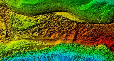
How UAVs Support Geospatial Analysis in the UK
Discover how UAVs support geospatial analysis in the UK, transforming the way we approach mapping, terrain modelling, and asset monitoring. This post explores the power of geospatial drone surveys, UAV mapping, and GIS drones for applications like flood risk assessment, urban development planning, and infrastructure inspections. Learn how drone data enhances accuracy, efficiency, and decision-making across key UK industries.

DJI Matrice 400: Redefining Enterprise Drone Technology
DJI’s latest enterprise drone, the Matrice 400, is set to redefine industrial UAV applications with its extended flight time, advanced obstacle sensing, and powerful automation capabilities. With a 59-minute endurance, a 6 kg payload capacity, and cutting-edge imaging technology, it delivers unparalleled reliability for emergency response, power inspections, mapping, and more. At Red Kite UAV, we are committed to harnessing the latest drone innovations—like the Matrice 400—to provide industry-leading solutions that enhance efficiency and precision. Read our full blog to discover how this groundbreaking drone is shaping the future of enterprise operations.